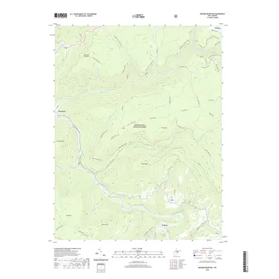
2019 Map of Mozark Mountain
USGS Topo · Published 2019About this map
Monongahela National Forest dominates this mountain landscape, where the Blackwater River and Dry Fork carve deep paths through the high plateaus of West Virginia. The map records a complex network of recreation and legacy infrastructure, including the historical Railraod Grade and numerous trails like the Dinky Jumpoff Trail and Lindy Point Trail. Local history is anchored by family names found at Lester Flanagan Spring and Kent Lambert Spring, as well as the Teter Cem near the settlement of Gladwin. Small communities such as Thomas and Hendricks sit at the map's edges, while the interior is defined by named peaks like Mozark Mtn and Canaan Mtn. The presence of several plantations and distinctive landmarks like Table Rock and Possession Camp suggests a history of early land use and seasonal habitation within the timbered highlands.
Find a feature on this map
53 named features on this map. Tap any name to fly to it.
Don’t see what you’re looking for? This feature index may not catch every label — zoom into the map to look around manually.
Map Details
Editions of this 2019 Mozark Mountain Map
This is the sole edition of this map. No revisions or reprints were ever made.
Other maps of this area

1886 · St. George
USGS Topo · 1:125,000

1889 · Beverly
USGS Topo · 1:125,000

1891 · St. George
USGS Topo · 1:125,000

1892 · Beverly
USGS Topo · 1:125,000

1892 · Franklin
USGS Topo · 1:125,000

1895 · Piedmont
USGS Topo · 1:125,000

1896 · Franklin
USGS Topo · 1:125,000

1908 · Parsons
USGS Topo · 1:62,500

1916 · Davis
USGS Topo · 1:48,000

1918 · Davis
USGS Topo · 1:62,500