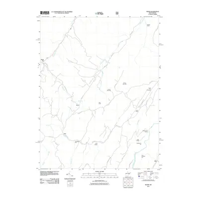
2011 Map of Mozer
USGS Topo · Published 2011About this map
Mozer and Kline sit within a landscape of parallel ridges and deep hollows in Pendleton County, documented here in the early 21st century. The geography is defined by the massive spine of Locust Mountain and Spring Mountain in the center, flanked by the South Fork South Branch Potomac River to the east and North Mill Creek to the northwest. This terrain dictates the path of local travel, with County Hwy-11 and County Hwy-220/3 following the natural contours between the summits. Small, named settlements like Brushy Run and Miles are situated along these transit corridors, while the higher elevations feature named peaks like High Knob and Huckleberry Hill. The map reveals how the early 2000s rural infrastructure utilized the gaps and valleys, such as Deep Hollow and Broadmouth Hollow, to connect isolated communities across the mountain barriers.
Find a feature on this map
41 named features on this map. Tap any name to fly to it.
Don’t see what you’re looking for? This feature index may not catch every label — zoom into the map to look around manually.
Map Details
Editions of this 2011 Mozer Map
This is the sole edition of this map. No revisions or reprints were ever made.
Other maps of this area

1892 · Franklin
USGS Topo · 1:125,000

1896 · Franklin
USGS Topo · 1:125,000

1920 · Petersburg
USGS Topo · 1:48,000

1920 · Onego
USGS Topo · 1:62,500

1921 · Petersburg
USGS Topo · 1:48,000

1921 · Onego
USGS Topo · 1:48,000

1922 · Onego
USGS Topo · 1:62,500

1922 · Fort Seybert
USGS Topo · 1:48,000

1922 · Petersburg
USGS Topo · 1:62,500

1922 · Circleville
USGS Topo · 1:62,500