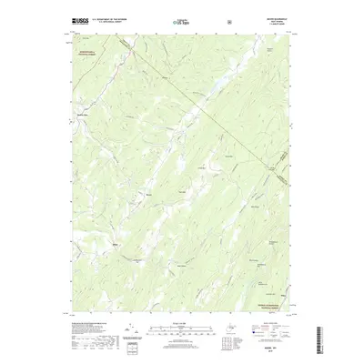
2019 Map of Mozer
USGS Topo · Published 2019About this map
Monongahela National Forest and George Washington National Forest converge in this high-altitude corner of the Potomac Highlands, where the South Fork South Branch Potomac River cuts through the southeastern ridges. Small agricultural settlements like Mozer, Kline, and Brushy Run occupy the narrow valleys between massive topographic features such as Kesner Mountain and South Fork Mtn. The landscape is defined by its dramatic relief, with numerous "hollows" and "runs" draining the slopes, including Broadmouth Hollow and Wards Run Spring. A network of rural routes, including Greenawalt Gap Rd and Us Rte 220, follows the natural breaks in the mountains, connecting isolated farmsteads and timber lands. The convergence of three counties—Grant, Hardy, and Pendleton—highlights the strategic position of these mountain passes in the Appalachian chain.
Find a feature on this map
72 named features on this map. Tap any name to fly to it.
Don’t see what you’re looking for? This feature index may not catch every label — zoom into the map to look around manually.
Map Details
Editions of this 2019 Mozer Map
This is the sole edition of this map. No revisions or reprints were ever made.
Other maps of this area

1892 · Franklin
USGS Topo · 1:125,000

1896 · Franklin
USGS Topo · 1:125,000

1920 · Petersburg
USGS Topo · 1:48,000

1920 · Onego
USGS Topo · 1:62,500

1921 · Petersburg
USGS Topo · 1:48,000

1921 · Onego
USGS Topo · 1:48,000

1922 · Onego
USGS Topo · 1:62,500

1922 · Fort Seybert
USGS Topo · 1:48,000

1922 · Petersburg
USGS Topo · 1:62,500

1922 · Circleville
USGS Topo · 1:62,500