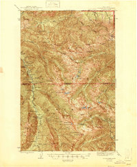
1946 Map of Mt. Angeles
USGS Topo · Published 1946About this map
Deer Park Lookout and a network of remote backcountry camps define this mid-century survey of the high Olympics. Mapped just after the war, the terrain reveals a landscape of logistical outposts and wilderness shelters, including Elkhorn Guard Sta, Drums Cabin, and Remanns Cabin. The drainage of the Elwha River and Lillian River dominates the western half, while the eastern reaches are marked by the Dosewallips River and high alpine features like the Cameron Glacier and Lillian Glacier. Historical camps such as Camp Baltimore, Tipperary Camp, and Waterhole Camp are plotted along these river valleys and ridges, serving as markers for early 20th-century forest management and recreation. The transition between the Olympic National Forest and the interior Olympic National Park is clearly delineated, showing the administrative boundaries during a period of significant land conservation in the Pacific Northwest.
Find a feature on this map
77 named features on this map. Tap any name to fly to it.
Don’t see what you’re looking for? This feature index may not catch every label — zoom into the map to look around manually.
Map Details
Editions of this 1946 Mt. Angeles Map
2 editions found
Other maps of this area

1918 · Port Angeles
USGS Topo · 1:62,500

1919 · Port Crescent
USGS Topo · 1:62,500

1935 · Mount Olympus
USGS Topo · 1:62,500

1938 · Mt Constance
USGS Topo · 1:125,000

1938 · Dungeness
USGS Topo · 1:62,500

1939 · Dungeness
USGS Topo · 1:62,500

1941 · Port Angeles
USGS Topo · 1:62,500

1942 · Mount Olympus
USGS Topo · 1:62,500

1944 · Mt. Angeles
USGS Topo · 1:62,500

1946 · Mt. Angeles
USGS Topo · 1:62,500