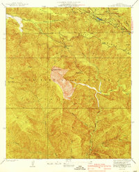
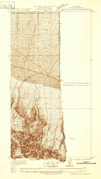
1940 Map of Mt. Baden-Powell
USGS Topo · Published 1940About this map
Big Horn Mine sits high on the southern slopes of the San Gabriel Mountains, a notable industrial feature in this high-altitude portion of the Angeles National Forest. Surveyed in the mid-1930s, the map reveals a landscape defined by sharp elevation changes and deep drainage systems, including Mine Gulch and Prairie Fork. The northern edge is dominated by the geological trace of the San Andreas Rift Zone Highway, which follows the structural depression where Jackson Lake and recreational sites like Camp Manzanita are located.
Find a feature on this map
32 named features on this map. Tap any name to fly to it.
Don’t see what you’re looking for? This feature index may not catch every label — zoom into the map to look around manually.
Map Details
Editions of this 1940 Mt. Baden-Powell Map
4 editions found
Other maps of this area

1901 · Southern California Sheet No. 1
USGS Topo · 1:250,000

1903 · Rock Creek
USGS Topo · 1:62,500

1903 · San Antonio
USGS Topo · 1:62,500

1904 · Southern California Sheet No. 1
USGS Topo · 1:250,000

1934 · Mescal Creek
USGS Topo · 1:24,000
1934 · Camp Baldy
USGS Topo · 1:24,000
1934 · Valyermo
USGS Topo · 1:24,000
1934 · Camp Bonita
USGS Topo · 1:24,000
1934 · Camp Rincon
USGS Topo · 1:24,000
1934 · Boneyard Canyon
USGS Topo · 1:24,000