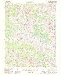
1985 Map of Mt. Clarence King
USGS Topo · Published 1985About this map
Pacific Crest National Scenic Trail (John Muir Trail) traverses this high-altitude landscape within Kings Canyon National Park, providing a vital corridor for travel through the Sierra Nevada during the mid-1980s. The terrain is defined by extreme elevations and glacial features, including the Sixty Lake Basin and the prominent King Spur. Significant peaks such as Mount Clarence King, Mount Cotter, and Mt Rixford dominate the horizon, while high-mountain passes like Glen Pass and Kearsarge Pass serve as traditional crossing points between the drainage of Bubbs Creek and the eastern slopes of the Inyo National Forest. This survey captures the specialized land use of the era, identifying the California Bighorn Sheep Zoological Area along the county boundaries. Notable resting spots for travelers and researchers are marked at Vidette Meadow and Junction Meadow, alongside numerous alpine water bodies like Charlotte Lake and Bullfrog Lake.
Find a feature on this map
45 named features on this map. Tap any name to fly to it.
Don’t see what you’re looking for? This feature index may not catch every label — zoom into the map to look around manually.
Map Details
Editions of this 1985 Mt. Clarence King Map
This is the sole edition of this map. No revisions or reprints were ever made.
Other maps of this area

1903 · Tehipite
USGS Topo · 1:125,000

1905 · Tehipite
USGS Topo · 1:125,000

1907 · Mt. Whitney
USGS Topo · 1:125,000

1919 · Mt. Whitney
USGS Topo · 1:125,000

1937 · Mt. Whitney
USGS Topo · 1:125,000

1948 · Fresno
USGS Topo · 1:250,000

1953 · Mt. Pinchot
USGS Topo · 1:62,500

1953 · Marion Peak
USGS Topo · 1:62,500

1955 · Fresno
USGS Topo · 1:250,000

1956 · Fresno
USGS Topo · 1:250,000