
1942 Map of Mt Jackson
USGS Topo · Published 1959About this map
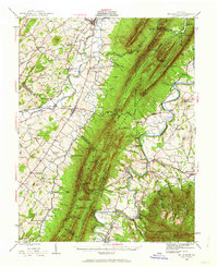
Massanutten Mountain dominates the central landscape of this survey, dividing the valley between the North Fork and South Fork Shenandoah River. The region’s early industrial roots are visible at Catherine Furnace, while the development of the river for energy is marked by the Massanutten Power Plant near Newport. Along the western valley, the Southern railway line services established communities like Quicksburg and New Market, while the eastern side of the ridge shows the Norfolk and Western rail corridor passing through Grove Hill and Ingham.
Find a feature on this map
110 named features on this map. Tap any name to fly to it.
Don’t see what you’re looking for? This feature index may not catch every label — zoom into the map to look around manually.
Map Details
Editions of this 1942 Mt Jackson Map
2 editions found
Other maps of this area

1892 · Woodstock
USGS Topo · 1:125,000

1892 · Gordonsville
USGS Topo · 1:125,000

1892 · Harrisonburg
USGS Topo · 1:125,000

1893 · Luray
USGS Topo · 1:125,000

1905 · Luray
USGS Topo · 1:125,000

1921 · Orkney Springs
USGS Topo · 1:48,000

1923 · Orkney Springs
USGS Topo · 1:62,500

1923 · Edinburg
USGS Topo · 1:62,500

1929 · Stony Man
USGS Topo · 1:48,000

1930 · Madison
USGS Topo · 1:48,000