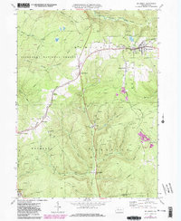
1969 Map of Mt Jewett
USGS Topo · Published 1981About this map
The borough of Mt Jewett and the surrounding highland landscape of the Allegheny National Forest are captured here in the late 1960s. The map illustrates a region deeply defined by its extractive industries, showing a dense concentration of Oil Wells and Gas Wells peppered across the townships of Hamlin, Wetmore, and Sergeant. The settlement pattern reflects this history, with small clusters like Halsey, Kanesholm, and the evocatively named Burning Well established along the drainage of the Clarion River and Kinzua Creek. Transportation is dominated by the Baltimore and Ohio rail corridor and several decommissioned paths, including an Old Railroad Grade and an Abandoned Grade that speak to the shifting industrial needs of the era. Local heritage is preserved in sites like Nebo Ch, St Josephs Ch, and Bridge View Cem, which overlook the complex network of pipelines and service roads.
Find a feature on this map
47 named features on this map. Tap any name to fly to it.
Don’t see what you’re looking for? This feature index may not catch every label — zoom into the map to look around manually.
Map Details
Editions of this 1969 Mt Jewett Map
4 editions found
Other maps of this area

1924 · Bradford
USGS Topo · 1:62,500

1926 · Bradford
USGS Topo · 1:62,500

1934 · Kane
USGS Topo · 1:48,000

1935 · Mt. Jewett
USGS Topo · 1:48,000

1936 · Kinzua
USGS Topo · 1:48,000

1939 · Kane
USGS Topo · 1:62,500

1940 · Mt. Jewett
USGS Topo · 1:62,500

1941 · Kinzua
USGS Topo · 1:62,500

1941 · Bradford
USGS Topo · 1:62,500

1944 · Bradford
USGS Topo · 1:62,500
Featured Places
- Mount Jewett, PA
- Cartwrights Crossing, Wetmore Township
- Griffiths, Hamlin Township
- Campbelltown, Hamlin Township
- Wetmore Township, PA