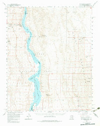
1959 Map of Mt. Perkins
USGS Topo · Published 1983About this map
Black Mountains geology and the intricate hydrology of the Colorado River basin dominate this 1959 field-checked survey of the borderlands between Arizona and Nevada. The map shows the Colorado River winding through the Lake Mead National Recreational Area, creating a sharp contrast between the deep waters of the river channel and the arid expanses of the Mohave Valley and Detrital Valley.
Find a feature on this map
40 named features on this map. Tap any name to fly to it.
Don’t see what you’re looking for? This feature index may not catch every label — zoom into the map to look around manually.
Map Details
Editions of this 1959 Mt. Perkins Map
4 editions found
Other maps of this area

1886 · Camp Mohave
USGS Topo · 1:250,000

1892 · Camp Mohave
USGS Topo · 1:250,000

1926 · Nelson
USGS Topo · 1:96,000

1926 · Mohave City
USGS Topo · 1:96,000

1942 · Camp Mohave
USGS Topo · 1:250,000

1947 · Kingman
USGS Topo · 1:250,000

1948 · Kingman
USGS Topo · 1:250,000

1954 · Kingman
USGS Topo · 1:250,000

1955 · Kingman
USGS Topo · 1:250,000

1958 · Kingman
USGS Topo · 1:250,000