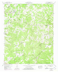
1949 Map of Mt Peter
USGS Topo · Published 1975About this map
The Tennessee Valley Divide snakes through this landscape, marking a significant hydrologic boundary between the northern drainages of Sweet Lips Creek and the southern flow of Cypress Creek. Along the northern edge, the community of Finger serves as a local hub, situated on the Illinois Central railroad. This transportation corridor was central to the area's development, connecting the small settlements of McNairy and Hogwallow to larger markets.
Find a feature on this map
70 named features on this map. Tap any name to fly to it.
Don’t see what you’re looking for? This feature index may not catch every label — zoom into the map to look around manually.
Map Details
Editions of this 1949 Mt Peter Map
2 editions found
Other maps of this area

1936 · Leapwood
USGS Topo · 1:24,000

1936 · Enville
USGS Topo · 1:24,000

1936 · Purdy
USGS Topo · 1:24,000

1936 · Stantonville
USGS Topo · 1:24,000

1936 · Mt. Peter
USGS Topo · 1:24,000

1949 · Leapwood
USGS Topo · 1:24,000

1949 · Mt. Peter
USGS Topo · 1:24,000

1949 · Purdy
USGS Topo · 1:24,000

1949 · Stantonville
USGS Topo · 1:24,000

1950 · Enville
USGS Topo · 1:24,000