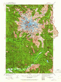
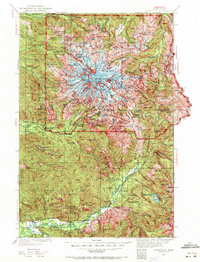
1924 Map of Mt Rainier
USGS Topo · Published 1961About this map
Mt Rainier dominates this 1924 landscape, its massive glacial systems like Willis Wall and the South Puyallup River radiating from the Columbia Crest. This survey captures the national park's infrastructure in the early decades of the twentieth century, anchored by the Longmire (Superintendents Headquarters). The map details early access points including the Nisqually Park Entrance Ranger Station and White River Entrance, alongside remote outposts such as the Carbon Ranger Sta.
Find a feature on this map
157 named features on this map. Tap any name to fly to it.
Don’t see what you’re looking for? This feature index may not catch every label — zoom into the map to look around manually.
Map Details
Editions of this 1924 Mt Rainier Map
6 editions found

Other maps of this area

1897 · Tacoma
USGS Topo · 1:125,000

1900 · Tacoma
USGS Topo · 1:125,000

1901 · Snoqualmie Pass
USGS Topo · 1:125,000

1902 · Mount Aix
USGS Topo · 1:125,000

1903 · Snoqualmie
USGS Topo · 1:125,000

1904 · Mt Aix
USGS Topo · 1:125,000

1904 · Mount Adams
USGS Topo · 1:125,000

1907 · Mount Adams
USGS Topo · 1:125,000

1913 · Cedar Lake
USGS Topo · 1:125,000

1919 · Mount St Helens
USGS Topo · 1:125,000