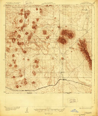
1918 Map of Mt. Riley
USGS Topo · Published 1929About this map
Volcanic peaks and isolated desert outposts dominate this borderland landscape during the late 1910s. The prominent massif of Mt Riley stands as a central landmark between the volcanic cinder cones of the West Potrillo Mountains and the uplifted ridge of the East Potrillo Mountains. The mapping captures a transition in desert survival, where reliance on scattered water sources like Cox Tank supported isolated operations at Phillips Ranch and Cox Ranch.
Find a feature on this map
12 named features on this map. Tap any name to fly to it.
Don’t see what you’re looking for? This feature index may not catch every label — zoom into the map to look around manually.
Map Details
Editions of this 1918 Mt. Riley Map
2 editions found
Other maps of this area

1891 · Las Cruces
USGS Topo · 1:125,000

1893 · Las Cruces
USGS Topo · 1:125,000

1917 · Camel Mountain
USGS Topo · 1:62,500

1917 · Noria
USGS Topo · 1:62,500

1917 · Mt. Riley
USGS Topo · 1:62,500

1918 · Mt. Riley
USGS Topo · 1:62,500

1918 · Noria
USGS Topo · 1:62,500

1929 · Mt. Riley
USGS Topo · 1:62,500

1941 · Aden
USGS Topo · 1:62,500

1943 · Aden
USGS Topo · 1:62,500