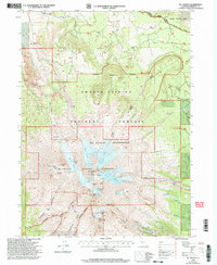
1998 Map of Mt. Shasta
USGS Topo · Published 2003About this map
The glacial systems and volcanic peaks of northern California define this topographic study, where the Mt Shasta Natural Landmark stands as the central focus. In the late 20th century, the landscape within the Mt Shasta Wilderness is meticulously documented, revealing the complex ice fields of the Whitney Glacier, Hotlum Glacier, and Wintun Glacier. The mapping detail captures the high-altitude terrain including the Shastina cone and the precarious Misery Hill, alongside geological landmarks such as The Heart and Thumb Rock.
Find a feature on this map
50 named features on this map. Tap any name to fly to it.
Don’t see what you’re looking for? This feature index may not catch every label — zoom into the map to look around manually.
Map Details
Editions of this 1998 Mt. Shasta Map
This is the sole edition of this map. No revisions or reprints were ever made.
Other maps of this area

1886 · Shasta
USGS Topo · 1:250,000

1894 · Shasta
USGS Topo · 1:250,000

1934 · Macdoel
USGS Topo · 1:96,000

1935 · Dunsmuir
USGS Topo · 1:125,000

1941 · Macdoel
USGS Topo · 1:125,000

1948 · Weed
USGS Topo · 1:250,000

1950 · Weed
USGS Topo · 1:250,000

1954 · The Whaleback
USGS Topo · 1:62,500

1954 · Shasta
USGS Topo · 1:62,500

1954 · Weed
USGS Topo · 1:62,500