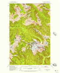
1953 Map of Mt Shuksan
USGS Topo · Published 1957About this map
Mount Baker National Forest defines this high-altitude landscape along the border between the United States and Canada in the early 1950s. The map illustrates a complex network of glacial activity and alpine hydrology, featuring the massive Sulphide Glacier, Upper Curtis Glacier, and Crystal Glacier surrounding the peak of Mt Shuksan. Human presence is marked by isolated outpost infrastructure like the Silesia Creek Shelter and seasonal mountain locations including Galena Camp and Camp Kiser.
Find a feature on this map
92 named features on this map. Tap any name to fly to it.
Don’t see what you’re looking for? This feature index may not catch every label — zoom into the map to look around manually.
Map Details
Editions of this 1953 Mt Shuksan Map
4 editions found
Other maps of this area

1909 · Mt Baker
USGS Topo · 1:192,000

1915 · Mt. Baker
USGS Topo · 1:250,000

1952 · Lake Shannon
USGS Topo · 1:62,500

1952 · Mt. Baker
USGS Topo · 1:62,500

1952 · Hamilton
USGS Topo · 1:62,500

1953 · Mt Shuksan
USGS Topo · 1:62,500

1953 · Marblemount
USGS Topo · 1:62,500

1953 · Mt Challenger
USGS Topo · 1:62,500

1955 · Concrete
USGS Topo · 1:250,000

1958 · Concrete
USGS Topo · 1:250,000