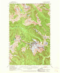
1953 Map of Mt Shuksan
USGS Topo · Published 1967About this map
Glaciated peaks and mining outposts define the landscape of Mount Baker National Forest in the mid-1950s. The survey captures the complex drainage of the Nooksack River and Silesia Creek, highlighting the high-altitude infrastructure of the era, from fire lookouts at Winchester Mtn Lookout and Lone Jack Mine Lookout to back-country shelters like Silesia Creek Shelter. The map provides detailed topographic evidence of the region’s active glaciers, including the Sulphide Glacier and East Nooksack Glacier flanking the massive Mt Shuksan.
Find a feature on this map
106 named features on this map. Tap any name to fly to it.
Don’t see what you’re looking for? This feature index may not catch every label — zoom into the map to look around manually.
Map Details
Editions of this 1953 Mt Shuksan Map
4 editions found
Other maps of this area

1909 · Mt Baker
USGS Topo · 1:192,000

1915 · Mt. Baker
USGS Topo · 1:250,000

1952 · Lake Shannon
USGS Topo · 1:62,500

1952 · Mt. Baker
USGS Topo · 1:62,500

1952 · Hamilton
USGS Topo · 1:62,500

1953 · Mt Shuksan
USGS Topo · 1:62,500

1953 · Marblemount
USGS Topo · 1:62,500

1953 · Mt Challenger
USGS Topo · 1:62,500

1955 · Concrete
USGS Topo · 1:250,000

1958 · Concrete
USGS Topo · 1:250,000