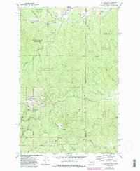
1973 Map of Mt Spokane
USGS Topo · Published 1986About this map
Mt Spokane stands as the central landmark of this high-altitude survey, where recreation and conservation define the landscape across the Washington and Idaho border. The map documents the extensive infrastructure within Mount Spokane State Park, featuring Vista House, Cooks Cabin, and a network of ski lifts radiating from the summit. To the east, the terrain transitions into the Coeur d'Alene Nat Forest, where more remote peaks like Horse Mtn and Quartz Mtn rise above the drainage of Sapper Creek. The presence of Prospects and a Mine near Deadman Creek suggests a legacy of resource exploration that predates the area's development as a winter sports destination. Historically significant features such as Camp Posseen and the primitive jeep trails through Blanchard Valley provide a look at the backcountry accessibility of the mid-1970s before modern road improvements.
Find a feature on this map
46 named features on this map. Tap any name to fly to it.
Don’t see what you’re looking for? This feature index may not catch every label — zoom into the map to look around manually.
Map Details
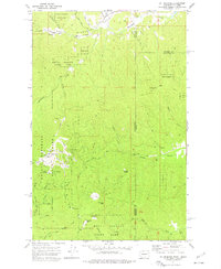
Editions of this 1973 Mt Spokane Map
2 editions found
Other maps of this area

1901 · Sandpoint
USGS Topo · 1:125,000

1901 · Spokane
USGS Topo · 1:125,000

1903 · Rathdrum
USGS Topo · 1:125,000

1911 · Priest Lake
USGS Topo · 1:250,000

1911 · Sandpoint
USGS Topo · 1:125,000

1913 · Priest Lake
USGS Topo · 1:250,000

1936 · Newport
USGS Topo · 1:96,000

1942 · Newport
USGS Topo · 1:125,000

1943 · Mt Spokane
USGS Topo · 1:62,500

1950 · Mt Spokane
USGS Topo · 1:62,500