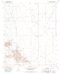
1968 Map of Mt. Tipton SE
USGS Topo · Published 1985About this map
The high desert of Mohave County is defined here by the stark meeting of the Cerbat Mountains and the broad Hualapai Valley (Depression). Surveyed in the late 1960s, the map documents a landscape where survival depends on dispersed water sources like Big Well, Cane Spring, and White Tank. The transportation network is sparse, centered on the historic Stockton Hill Road and the route leading toward Pierce Ferry Road. Topography is dominated by the steep drainage of Tipton Canyon and the seasonal paths of Twentysix Wash and Truxton Wash, which carve through the arid basin. This map serves as a detailed record of the desert's physical infrastructure before later regional development, focusing on the essential wells and tanks that once supported ranching and transit in this part of Arizona.
Find a feature on this map
15 named features on this map. Tap any name to fly to it.
Don’t see what you’re looking for? This feature index may not catch every label — zoom into the map to look around manually.
Map Details
Editions of this 1968 Mt. Tipton SE Map
2 editions found
Other maps of this area

1886 · Diamond Creek
USGS Topo · 1:250,000

1886 · Camp Mohave
USGS Topo · 1:250,000

1892 · Diamond Creek
USGS Topo · 1:250,000

1892 · Camp Mohave
USGS Topo · 1:250,000

1939 · Chloride
USGS Topo · 1:48,000

1942 · Camp Mohave
USGS Topo · 1:250,000

1944 · Chloride
USGS Topo · 1:62,500

1947 · Kingman
USGS Topo · 1:250,000

1948 · Kingman
USGS Topo · 1:250,000

1948 · Williams
USGS Topo · 1:250,000