
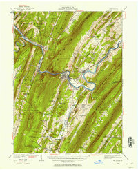
1922 Map of Mt Union
USGS Topo · Published 1922About this map
Juniata River and the Pennsylvania RR corridor dominate the central geography of this central Pennsylvania landscape. Surveyed in 1922, the map shows the transition from the river-valley industry at Mapleton Depot to the agricultural pockets within Aughwick Valley and Hare Valley. The era’s transportation network is clearly defined by the Lincoln Highway and the Broad Top Highway, linking river settlements like Newton Hamilton with the rural interior.
Find a feature on this map
111 named features on this map. Tap any name to fly to it.
Don’t see what you’re looking for? This feature index may not catch every label — zoom into the map to look around manually.
Map Details
Editions of this 1922 Mt Union Map
2 editions found
Other maps of this area

1901 · Huntingdon
USGS Topo · 1:62,500

1904 · Huntingdon
USGS Topo · 1:62,500

1919 · Mattawana
USGS Topo · 1:62,500

1919 · Menno
USGS Topo · 1:62,500

1923 · Shippensburg
USGS Topo · 1:62,500

1923 · Tyrone
USGS Topo · 1:62,500

1924 · Mt. Union
USGS Topo · 1:62,500

1924 · Lewistown
USGS Topo · 1:62,500

1927 · Lewisburg
USGS Topo · 1:62,500

1929 · Tyrone
USGS Topo · 1:48,000