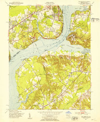
1951 Map of Mt Vernon
USGS Topo · Published 1953About this map
Mount Vernon stands as a focal point along the western banks of the Potomac River during the early 1950s, a period marked by suburban expansion across the Fairfax County countryside. This survey captures a mix of historic estates and mid-century developments, including Hybla Valley Airport and a Drive-in Theatre near Gum Springs. On the Maryland shore, the landscape remains largely rural, defined by the tidal flats of Piscataway Creek and the wooded terrain around Accokeek. The map provides a detailed view of regional transportation before the modern beltway era, highlighting the Mount Vernon Memorial Highway and the Indian Head Highway. Defensive structures like Fort Washington and Fort Hunt anchor the river approaches, while smaller communities such as Wellington, Collingwood, and Bryans Road appear as they existed before decades of later commercial growth.
Find a feature on this map
65 named features on this map. Tap any name to fly to it.
Don’t see what you’re looking for? This feature index may not catch every label — zoom into the map to look around manually.
Map Details
Editions of this 1951 Mt Vernon Map
2 editions found
Other maps of this area

1890 · Mt. Vernon
USGS Topo · 1:125,000

1891 · Mt. Vernon
USGS Topo · 1:125,000

1892 · Brandywine
USGS Topo · 1:62,500

1894 · Mt. Vernon
USGS Topo · 1:125,000

1895 · Brandywine
USGS Topo · 1:62,500

1897 · Mt. Vernon
USGS Topo · 1:125,000

1899 · Patuxent
USGS Topo · 1:125,000

1900 · Washington
USGS Topo · 1:62,500

1906 · Patuxent
USGS Topo · 1:125,000

1911 · Brandywine
USGS Topo · 1:62,500