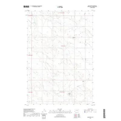
2018 Map of Mud Buttes
USGS Topo · Published 2018About this map
The Little Missouri River cuts through the northwest corner of this Bowman County landscape, anchoring a complex system of drainage that includes Skull Cr and Horse Cr. The topography is defined by significant elevations such as Rattlesnake Buttes in the northern reaches and the namesake Mud Buttes to the southeast. These formations rise above the surrounding prairie, illustrating the erosional forces that have shaped the North Dakota badlands. Human imprint on this rural expanse is sparse, marked by the Vernon Miller Private Airport and a grid of secondary roads like 163rd Ave SW. The map captures a transitional terrain where various waterways, including Sevenmile Cr and Fivemile Cr, converge toward the river valley, providing a clear view of land use and natural drainage patterns in the late 2010s.
Find a feature on this map
17 named features on this map. Tap any name to fly to it.
Don’t see what you’re looking for? This feature index may not catch every label — zoom into the map to look around manually.
Map Details
Editions of this 2018 Mud Buttes Map
This is the sole edition of this map. No revisions or reprints were ever made.
Other maps of this area

1935 · Buffalo
USGS Topo · 1:125,000

1953 · Dickinson
USGS Topo · 1:250,000

1954 · Lemmon
USGS Topo · 1:250,000

1957 · Dickinson
USGS Topo · 1:250,000

1957 · Lemmon
USGS Topo · 1:250,000

1969 · Table Mountain
USGS Topo · 1:24,000

1973 · Kid Creek
USGS Topo · 1:24,000

1973 · Camel Butte
USGS Topo · 1:24,000

1973 · Cedar Hills
USGS Topo · 1:24,000
1973 · Mud Buttes
USGS Topo · 1:24,000