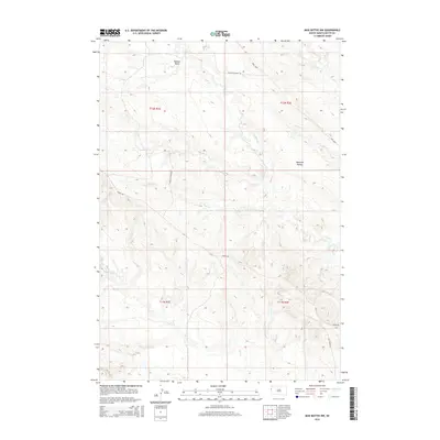
2015 Map of Mud Buttes NW
USGS Topo · Published 2015About this map
Watson Draw and the family-named Vankley Ranch Rd reveal the pastoral character of Butte County in this modern 2015 survey. The landscape is defined by a dense network of intermittent drainages, including the branching forks of N Indian Cr and S Indian Cr, which flow through the undulating terrain of Opossum Hollow. This corner of the Black Hills region is etched with localized ranching infrastructure, where routes like Albion Rd and Owl Basin Rd connect isolated homesteads across the townships of T11N and T12N. The presence of Williston Basin Rd and the MDU Loop points to the area's role in energy transportation and mineral exploration within the larger sedimentary basin. For researchers, these precise creek alignments, such as Lonetree Cr and Short Cr, provide a contemporary baseline for understanding land use and water rights in this rural South Dakota environment.
Find a feature on this map
18 named features on this map. Tap any name to fly to it.
Don’t see what you’re looking for? This feature index may not catch every label — zoom into the map to look around manually.
Map Details
Editions of this 2015 Mud Buttes NW Map
This is the sole edition of this map. No revisions or reprints were ever made.
Other maps of this area

1901 · Aladdin
USGS Topo · 1:125,000

1903 · Aladdin
USGS Topo · 1:125,000

1905 · Indian
USGS Topo · 1:62,500

1907 · Belle Fourche
USGS Topo · 1:125,000

1935 · Harding
USGS Topo · 1:125,000

1953 · Rapid City
USGS Topo · 1:250,000

1954 · Lemmon
USGS Topo · 1:250,000

1954 · Ekalaka
USGS Topo · 1:250,000

1954 · Gillette
USGS Topo · 1:250,000

1955 · Gillette
USGS Topo · 1:250,000