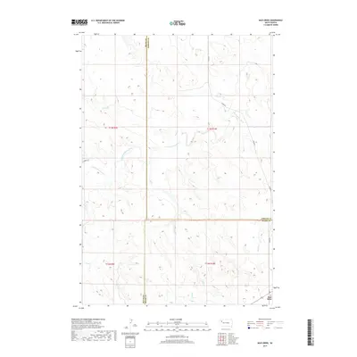
2017 Map of Mud Creek
USGS Topo · Published 2017About this map
Mud Butte serves as the primary landmark in this ranching landscape where Meade, Butte, and Perkins Counties converge. The terrain is defined by the winding course of the S Fork Moreau River, which draws in a network of drainage systems including Mud Cr, Hay Cr, and Trail Cr. This 2017 survey reveals a remote section of South Dakota characterized by wide-open land divisions and sparse infrastructure, where travel is dictated by routes like Zeona Rd. The convergence of multiple county lines, including the boundary between Butte and Meade counties, highlights the administrative importance of this rural intersection. Small seasonal waterways such as Camper Cr and Beverly Cr illustrate the local topography, which remains largely dominated by natural features and large-scale township grids rather than dense settlement.
Find a feature on this map
16 named features on this map. Tap any name to fly to it.
Don’t see what you’re looking for? This feature index may not catch every label — zoom into the map to look around manually.
Map Details
Editions of this 2017 Mud Creek Map
This is the sole edition of this map. No revisions or reprints were ever made.
Other maps of this area

1913 · Newell
USGS Topo · 1:125,000

1935 · Hoover
USGS Topo · 1:125,000

1953 · Rapid City
USGS Topo · 1:250,000

1954 · Lemmon
USGS Topo · 1:250,000

1957 · Lemmon
USGS Topo · 1:250,000

1957 · Rapid City
USGS Topo · 1:250,000

1973 · Frozen Man Creek
USGS Topo · 1:24,000
1978 · Owl Butte NE
USGS Topo · 1:24,000
1978 · Camp Creek
USGS Topo · 1:24,000
1978 · Fish Draw
USGS Topo · 1:24,000