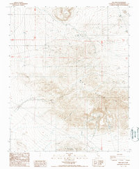
1988 Map of Mud Hills
USGS Topo · Published 1988About this map
Mud Hills dominate this high-desert landscape in San Bernardino County, where the terrain is marked by deep geological erosions and historic extraction sites. The northern portion of the quadrangle is anchored by the Coolgardie Camp settlement, situated near several quarries and mines that highlight the area's industrial utility during the late 1980s. The central and southern regions are defined by intricate drainage systems, most notably the winding paths of Fossil Canyon and Coon Canyon.
Find a feature on this map
16 named features on this map. Tap any name to fly to it.
Don’t see what you’re looking for? This feature index may not catch every label — zoom into the map to look around manually.
Map Details
Editions of this 1988 Mud Hills Map
2 editions found
Other maps of this area

1915 · Searles Lake
USGS Topo · 1:250,000

1932 · Barstow
USGS Topo · 1:125,000

1933 · Avawatz Mountains
USGS Topo · 1:250,000

1934 · Barstow
USGS Topo · 1:125,000

1947 · Trona
USGS Topo · 1:250,000

1948 · Trona
USGS Topo · 1:250,000

1948 · Lane Mountain
USGS Topo · 1:62,500

1951 · Lane Mountain
USGS Topo · 1:62,500

1953 · San Bernardino
USGS Topo · 1:250,000

1953 · Trona
USGS Topo · 1:250,000