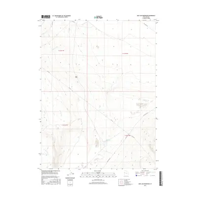
2017 Map of Mud Lake Reservoir
USGS Topo · Published 2017About this map
Snake Valley occupies the heart of this high-desert landscape in Juab County, where the sparse topography is defined by seasonal watercourses and historic transportation routes. The eponymous Mud Lake Reservoir sits as a primary landmark in the southern portion of the quadrangle, serving as a critical water source in an otherwise arid environment. This 2017 survey details the drainage patterns of Indian Farm Cr, Toms Cr, and Red Cedar Cr as they descend from higher elevations toward the valley floor.
Find a feature on this map
12 named features on this map. Tap any name to fly to it.
Don’t see what you’re looking for? This feature index may not catch every label — zoom into the map to look around manually.
Map Details
Editions of this 2017 Mud Lake Reservoir Map
This is the sole edition of this map. No revisions or reprints were ever made.
Other maps of this area

1908 · Fish Springs
USGS Topo · 1:250,000

1910 · Fish Springs
USGS Topo · 1:250,000

1953 · Delta
USGS Topo · 1:250,000

1958 · Delta
USGS Topo · 1:250,000

1960 · Granite Mountain
USGS Topo · 1:62,500

1961 · Trout Creek
USGS Topo · 1:62,500

1962 · Delta
USGS Topo · 1:250,000

1972 · Mud Lake Reservoir
USGS Topo · 1:24,000
1972 · Boyd Station
USGS Topo · 1:24,000
1972 · Goshute Canyon
USGS Topo · 1:24,000