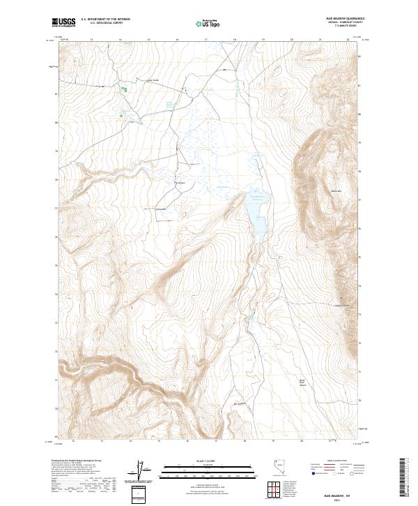
2021 Map of Mud Meadow
USGS Topo · Published 2021About this map
Soldier Meadows Hot Springs serves as a focal point in this high-desert basin, where geothermal activity and seasonal water sources define the remote landscape of Humboldt County. The terrain transitions from the marshy expanse of Mud Meadow and the catchment of Mud Meadow Reservoir to the stark, arid flats of the Black Rock Desert in the southeast corner. Steep elevation changes are marked by Black Mtn and a series of dramatic incisions including Fly Canyon, Copper Canyon, and Box Canyon. This 2021 survey illustrates the precarious balance of water in the Great Basin, tracing the paths of Fly Cr and Mud Meadow Cr as they feed into isolated sinks and springs like Mud Spring and Wheeler Spring, essential landmarks for navigation and survival in this unforgiving environment.
Find a feature on this map
18 named features on this map. Tap any name to fly to it.
Don’t see what you’re looking for? This feature index may not catch every label — zoom into the map to look around manually.
Map Details
Editions of this 2021 Mud Meadow Map
This is the sole edition of this map. No revisions or reprints were ever made.
Other maps of this area

1889 · Long Valley
USGS Topo · 1:250,000

1954 · Vya
USGS Topo · 1:250,000

1958 · Vya
USGS Topo · 1:250,000

1962 · Vya
USGS Topo · 1:250,000

1972 · Mud Meadow
USGS Topo · 1:24,000

1972 · Soldier Meadow
USGS Topo · 1:24,000

1972 · High Rock Lake
USGS Topo · 1:24,000

1972 · Big Mountain
USGS Topo · 1:24,000
1972 · Red Mountain
USGS Topo · 1:24,000
1972 · Yellow Hills East
USGS Topo · 1:24,000