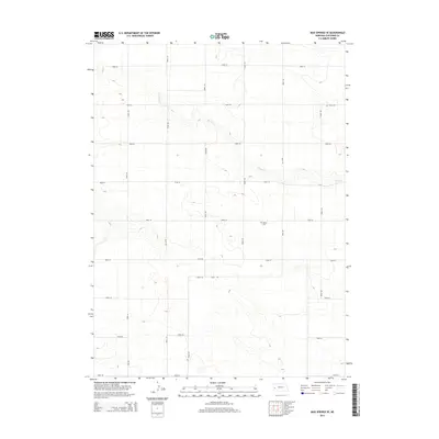
2014 Map of Mud Springs SE
USGS Topo · Published 2014About this map
Salem Cem serves as a central landmark in this high-plains landscape of Cheyenne County, situated within a sparse grid of section-line roads. The drainage of Rush Cr meanders across the northern and eastern portions of the map, carving subtle relief into the terrain as it flows through this agricultural region. This 2014 survey documents the organized layout of rural Nebraska, where long thoroughfares such as Road 101 and Road 52 define the boundaries of large-scale landholdings. To the south, the appearance of 2nd Ave near Road 36 indicates the encroaching influence of more developed corridors. The map provides a precise look at the modern rural infrastructure, preserving the locations of historical burial grounds and local waterways essential to the identity of the Nebraska panhandle.
Find a feature on this map
19 named features on this map. Tap any name to fly to it.
Don’t see what you’re looking for? This feature index may not catch every label — zoom into the map to look around manually.
Map Details
Editions of this 2014 Mud Springs SE Map
This is the sole edition of this map. No revisions or reprints were ever made.
Other maps of this area

1899 · Sidney
USGS Topo · 1:125,000

1954 · Scottsbluff
USGS Topo · 1:250,000

1958 · Scottsbluff
USGS Topo · 1:250,000

1972 · Gurley
USGS Topo · 1:24,000

1972 · Mud Springs SW
USGS Topo · 1:24,000
1972 · Dalton
USGS Topo · 1:24,000

1972 · Point Of Rocks
USGS Topo · 1:24,000

1972 · Brownson
USGS Topo · 1:24,000

1972 · Horsehead Ranch
USGS Topo · 1:24,000

1972 · Mud Springs SE
USGS Topo · 1:24,000