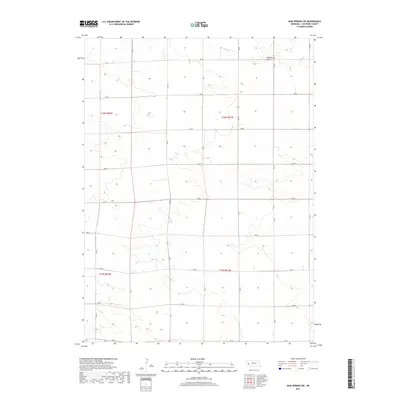
2017 Map of Mud Springs SW
USGS Topo · Published 2017About this map
Wild Horse Draw and Rush Cr define the northern drainage patterns of this high-plains landscape in Cheyenne County. This 2017 survey shows a region organized by the Public Land Survey System, where townships like t16n r51w and t16n r52w are bisected by a precise grid of rural routes. These roads, from RD 52 in the north down to RD 36 at the southern boundary, follow the section lines that historically carved this territory into homesteads and ranch land. The sparse distribution of labels reflects the open-range character of the Nebraska Panhandle, where water features and section-line roads serve as the primary landmarks for navigation and land ownership.
Find a feature on this map
15 named features on this map. Tap any name to fly to it.
Don’t see what you’re looking for? This feature index may not catch every label — zoom into the map to look around manually.
Map Details
Editions of this 2017 Mud Springs SW Map
This is the sole edition of this map. No revisions or reprints were ever made.
Other maps of this area

1954 · Scottsbluff
USGS Topo · 1:250,000

1958 · Scottsbluff
USGS Topo · 1:250,000

1972 · Mud Springs SW
USGS Topo · 1:24,000

1972 · Point Of Rocks
USGS Topo · 1:24,000

1972 · Brownson
USGS Topo · 1:24,000

1972 · Horsehead Ranch
USGS Topo · 1:24,000

1972 · Mud Springs SE
USGS Topo · 1:24,000
1972 · Mud Springs
USGS Topo · 1:24,000

1972 · Potter
USGS Topo · 1:24,000

1973 · Potter 2 SE
USGS Topo · 1:24,000