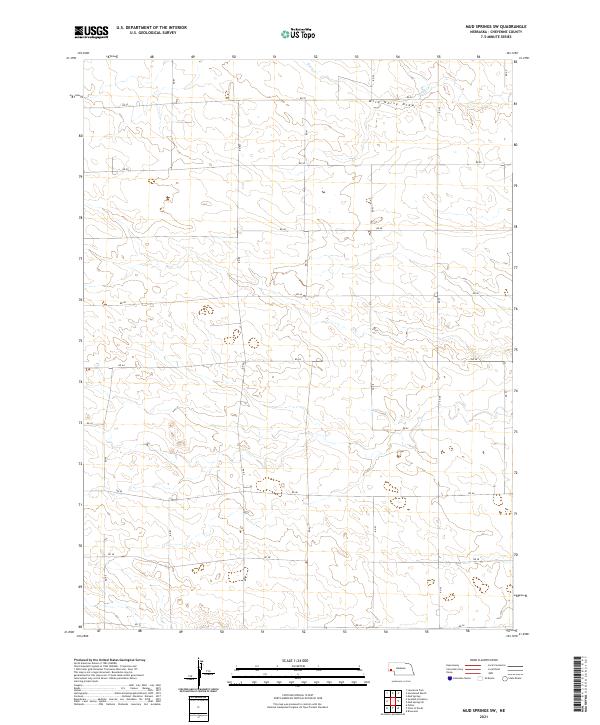
2021 Map of Mud Springs SW
USGS Topo · Published 2021About this map
Wild Horse Draw dominates the northern landscape of this Cheyenne County region, illustrating the characteristic drainage patterns of the high plains. This 2021 survey shows a geometric grid of rural roads, including Rd 52 and Rd 85, which segment the terrain into the township and range divisions of t16n r51w and t15n r52w. The ephemeral nature of the local hydrology is evident in the path of Rush Cr, a seasonal watercourse that cuts through the northern sections of the map. This area remains primarily defined by its agricultural layout, with the road network providing the primary structure for the few scattered ranch or farm improvements indicated across the expansive sections.
Find a feature on this map
22 named features on this map. Tap any name to fly to it.
Don’t see what you’re looking for? This feature index may not catch every label — zoom into the map to look around manually.
Map Details
Editions of this 2021 Mud Springs SW Map
This is the sole edition of this map. No revisions or reprints were ever made.
Other maps of this area

1954 · Scottsbluff
USGS Topo · 1:250,000

1958 · Scottsbluff
USGS Topo · 1:250,000

1972 · Mud Springs SW
USGS Topo · 1:24,000

1972 · Point Of Rocks
USGS Topo · 1:24,000

1972 · Brownson
USGS Topo · 1:24,000

1972 · Horsehead Ranch
USGS Topo · 1:24,000

1972 · Mud Springs SE
USGS Topo · 1:24,000
1972 · Mud Springs
USGS Topo · 1:24,000

1972 · Potter
USGS Topo · 1:24,000

1973 · Potter 2 SE
USGS Topo · 1:24,000