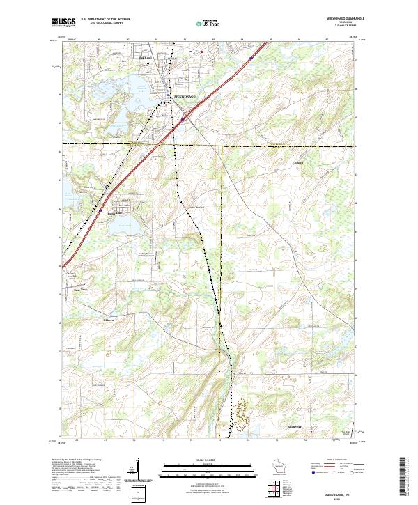
2022 Map of Mukwonago
USGS Topo · Published 2022About this map
Mukwonago and its surrounding wetlands form a complex hydraulic landscape where the Mukwonago River joins the Fox River system. The area is defined by numerous glacial lakes, including Lower Phantom Lake, Phantom Lake, and the expansive Lake Beulah, which features Gaskells Bay in its northern reaches. To the south, the settlement of Potter Lake borders its namesake water body, illustrating the dense residential development around these regional recreation hubs.
Find a feature on this map
98 named features on this map. Tap any name to fly to it.
Don’t see what you’re looking for? This feature index may not catch every label — zoom into the map to look around manually.
Map Details
Editions of this 2022 Mukwonago Map
This is the sole edition of this map. No revisions or reprints were ever made.
Other maps of this area

1891 · Muskego
USGS Topo · 1:62,500

1892 · Eagle
USGS Topo · 1:62,500

1893 · Silver Lake
USGS Topo · 1:62,500

1893 · Geneva
USGS Topo · 1:62,500

1894 · Eagle
USGS Topo · 1:62,500

1897 · Eagle
USGS Topo · 1:62,500

1901 · Muskego
USGS Topo · 1:62,500

1904 · Lake Geneva
USGS Topo · 1:62,500

1906 · Eagle
USGS Topo · 1:62,500

1906 · Silver Lake
USGS Topo · 1:62,500