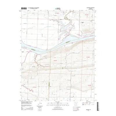
2014 Map of Mulberry
USGS Topo · Published 2014About this map
Mulberry serves as the focal point of this region where the Arkansas River forms a major geographic boundary, carving past Arbuckle Island and feeding into Ozark Lake. The topography shifts from the river flats to the prominent elevation of Mill Creek Mtn, a landmark that dominates the central southern portion of the survey. The landscape is a mosaic of small settlements and agricultural infrastructure, with Pleasant View and Riverdale established along the northern and western reaches. Local history and genealogy are well-represented by numerous family and community landmarks, including Pleasant View Cem, Hight Cem, and Hepseby Cem. The southern landscape is further characterized by the presence of the Vesta Gas Field near the settlement of Vesta, highlighting the area's mix of traditional land use and energy resource development along the Onion Cr and Hall Cr drainages.
Find a feature on this map
82 named features on this map. Tap any name to fly to it.
Don’t see what you’re looking for? This feature index may not catch every label — zoom into the map to look around manually.
Map Details
Editions of this 2014 Mulberry Map
This is the sole edition of this map. No revisions or reprints were ever made.
Other maps of this area

1879 · Cravens
USGS Topo · 1:62,500

1887 · Magazine Mountain #2
USGS Topo · 1:62,500

1887 · Watalula
USGS Topo · 1:62,500

1887 · Magazine Mountain
USGS Topo · 1:62,500

1890 · Magazine Mountain
USGS Topo · 1:125,000

1890 · Fort Smith
USGS Topo · 1:125,000

1898 · Winslow #4
USGS Topo · 1:62,500

1898 · Winslow
USGS Topo · 1:125,000

1901 · Winslow
USGS Topo · 1:125,000

1906 · Lavaca
USGS Topo · 1:62,500