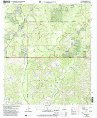
2000 Map of Mulberry
USGS Topo · Published 2002About this map
The Chickasawhay State Wildlife Management Area and the De Soto National Forest define this landscape at the intersection of Wayne, Perry, and Greene Counties. The small settlement of Mulberry serves as a local landmark near the winding path of Thompson Creek. This 2000 revision shows a rural environment deeply intertwined with public forest lands and conservation boundaries.
Find a feature on this map
28 named features on this map. Tap any name to fly to it.
Don’t see what you’re looking for? This feature index may not catch every label — zoom into the map to look around manually.
Map Details
Editions of this 2000 Mulberry Map
This is the sole edition of this map. No revisions or reprints were ever made.
Other maps of this area

1953 · Hattiesburg
USGS Topo · 1:250,000

1958 · Hattiesburg
USGS Topo · 1:250,000

1963 · Brewer
USGS Topo · 1:24,000

1964 · Rhodes
USGS Topo · 1:24,000

1964 · Richton
USGS Topo · 1:24,000

1964 · Clara
USGS Topo · 1:24,000

1964 · Strengthford
USGS Topo · 1:24,000

1964 · Mulberry
USGS Topo · 1:24,000

1964 · Avera
USGS Topo · 1:24,000

1964 · Piave
USGS Topo · 1:24,000