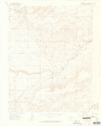
1963 Map of Muldoon Hill
USGS Topo · Published 1965About this map
Muldoon Hill rises above a landscape defined by ranching and water management in this mid-1960s survey. The area's focus on irrigation is evident through the St Charles Flood Ditch and its proximity to the St Charles River, which winds through the central portion of the quadrangle. Early infrastructure is marked by the presence of several mines on the northern slopes and the settlement at Burnt Mill, where Burnt Mill Road and Pollard Road converge. These transport routes, including Three R Road, follow the natural drainage patterns of intermittent streams like Rock Creek, Stinking Arroyo, and Muddy Creek. Local place names such as Wales and Stinking Spring provide grounding for family historians tracking rural land use before modern development patterns fully took hold in the region.
Find a feature on this map
20 named features on this map. Tap any name to fly to it.
Don’t see what you’re looking for? This feature index may not catch every label — zoom into the map to look around manually.
Map Details
Editions of this 1963 Muldoon Hill Map
This is the sole edition of this map. No revisions or reprints were ever made.
Other maps of this area

1891 · Walsenburg
USGS Topo · 1:125,000

1891 · Pueblo
USGS Topo · 1:125,000

1894 · Walsenburg
USGS Topo · 1:125,000

1894 · Pueblo
USGS Topo · 1:125,000

1896 · Pueblo
USGS Topo · 1:125,000

1897 · Pueblo
USGS Topo · 1:125,000

1897 · Walsenburg
USGS Topo · 1:125,000

1900 · Walsenburg
USGS Topo · 1:125,000

1954 · Trinidad
USGS Topo · 1:250,000

1954 · Pueblo
USGS Topo · 1:250,000