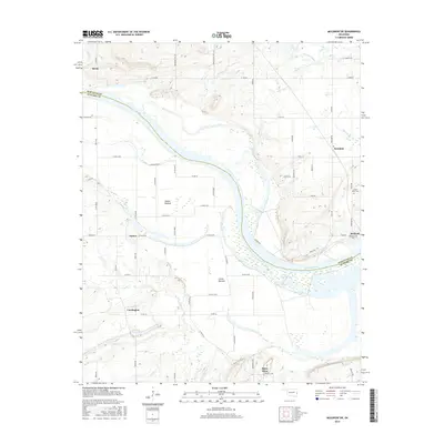
2016 Map of Muldrow SW
USGS Topo · Published 2016About this map
The Arkansas River serves as the primary geographic corridor through this borderland region, dividing Sequoyah Co and Le Flore Co. The landscape is defined by the broad, low-lying floodplains of Tucker Bottom and Cache Bottom, which have historically dictated the placement of settlements and transport routes away from the active river bends. Small rural communities like Cowlington, Tucker, and Foreman anchor the local road network, which consists largely of county roads and named lanes like Woodruff Hill Rd.
Find a feature on this map
70 named features on this map. Tap any name to fly to it.
Don’t see what you’re looking for? This feature index may not catch every label — zoom into the map to look around manually.
Map Details
Editions of this 2016 Muldrow SW Map
This is the sole edition of this map. No revisions or reprints were ever made.
Other maps of this area

1900 · Sallisaw
USGS Topo · 1:125,000

1911 · Sallisaw
USGS Topo · 1:125,000

1946 · Fort Smith
USGS Topo · 1:250,000

1965 · Fort Smith
USGS Topo · 1:250,000
1966 · Muldrow
USGS Topo · 1:24,000

1966 · Gans
USGS Topo · 1:24,000

1966 · Muldrow SW
USGS Topo · 1:24,000

1967 · Fort Smith
USGS Topo · 1:250,000
1967 · Sallisaw
USGS Topo · 1:24,000

1967 · Robert S Kerr Dam
USGS Topo · 1:24,000