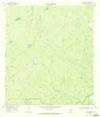
1969 Map of Mule Creek
USGS Topo · Published 1972About this map
Mule Creek and its many tributaries carve through this South Texas landscape in the late 1960s, defined by a ranching infrastructure of scattered stock tanks and remote industrial outposts. The southern reach of the map is dominated by the Nueces River and the winding Elm Slough, while a portion of a Military Reservation Boundary cuts across the lower sections. The presence of Oil Wells and a Gravel Pit indicates the area's mid-century extractive economy. One of the more distinct landmarks is the Noria Caliente Flowing Well (Hot), a notable water source in this semi-arid terrain. Named water features like Big Mule Tank, Llano Grande Tank, and Medio de Llano Tank reveal how the land was managed for livestock during this era, with an Observation Tower providing a high-ground vantage point overlooking the drainage basins of Caballo Creek and Guadalupe Creek.
Find a feature on this map
25 named features on this map. Tap any name to fly to it.
Don’t see what you’re looking for? This feature index may not catch every label — zoom into the map to look around manually.
Map Details
Editions of this 1969 Mule Creek Map
2 editions found
Other maps of this area

1925 · Tilden No. 1
USGS Topo · 1:48,000

1930 · Tilden
USGS Topo · 1:62,500

1937 · Loma Alta
USGS Topo · 1:62,500

1942 · Fowlerton
USGS Topo · 1:62,500

1942 · Tilden
USGS Topo · 1:62,500

1953 · Crystal City
USGS Topo · 1:250,000

1955 · Crystal City
USGS Topo · 1:250,000

1956 · Piedra Creek
USGS Topo · 1:62,500

1956 · Fowlerton
USGS Topo · 1:62,500

1961 · Crystal City
USGS Topo · 1:250,000