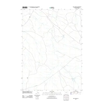
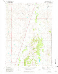
2012 Map of Mule Creek
USGS Topo · Published 2012About this map
Mule Creek and its various tributaries, including W Mule Creek and E Mule Creek, dominate this high plains drainage system in Niobrara County. The landscape is characterized by a network of intermittent streams and water management features like the Mule Creek Number 1 Reservoir and Geiger Reservoir, which support the region's ranching economy. Transportation is anchored by the corridor of Old US Hwy 85, which traverses the northern and southern portions of the quadrangle. Notable topographic landmarks include The Flat Top, a distinctive landform rising above the surrounding drainage basins of Hon Creek, Bridge Creek, and Sage Creek. This 2012 survey illustrates the modern configuration of rural Wyoming rangeland where water access remains the primary driver of land use and connectivity.
Find a feature on this map
10 named features on this map. Tap any name to fly to it.
Don’t see what you’re looking for? This feature index may not catch every label — zoom into the map to look around manually.
Map Details
Editions of this 2012 Mule Creek Map
This is the sole edition of this map. No revisions or reprints were ever made.
Other maps of this area

1951 · Twentyone Divide
USGS Topo · 1:24,000

1955 · Newcastle
USGS Topo · 1:250,000

1958 · Newcastle
USGS Topo · 1:250,000

1978 · Riverview
USGS Topo · 1:24,000

1978 · Mule Creek
USGS Topo · 1:24,000

1978 · Coffee Flats
USGS Topo · 1:24,000
1978 · Oat Creek NW
USGS Topo · 1:24,000
1978 · Mule Creek SE
USGS Topo · 1:24,000
1981 · Little Alkali Creek
USGS Topo · 1:24,000
1981 · Redbird
USGS Topo · 1:24,000