
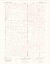
1978 Map of Riverview
USGS Topo · Published 1979About this map
The Cheyenne River winds through the high plains of Niobrara County, carving a wide valley floor where the small settlement of Riverview and the Cheyenne River Sch were established. This 1970s landscape is deeply tied to historical travel and infrastructure, evidenced by the Robbers Roost Stage Sta (Site) located near the riverbank. The terrain is defined by a complex network of ephemeral drainages, including Robbers Roost Creek, Bobcat Creek, and Mule Creek, which converge in this arid ranching country. Transportation is anchored by the long, straight stretch of highway passing through Mule Creek Junction and the local Cheyenne River Road. Notable industrial and logistical features such as a Pumping Station, multiple Landing Strips, and a Gaging Sta reveal how modern utility and aviation supported this isolated Wyoming community.
Find a feature on this map
26 named features on this map. Tap any name to fly to it.
Don’t see what you’re looking for? This feature index may not catch every label — zoom into the map to look around manually.
Map Details
Editions of this 1978 Riverview Map
This is the sole edition of this map. No revisions or reprints were ever made.
Other maps of this area

1899 · Newcastle
USGS Topo · 1:125,000

1901 · Newcastle
USGS Topo · 1:125,000

1951 · Dewey
USGS Topo · 1:24,000

1951 · Dewey SW
USGS Topo · 1:24,000

1951 · Twentyone Divide
USGS Topo · 1:24,000

1955 · Newcastle
USGS Topo · 1:250,000

1958 · Newcastle
USGS Topo · 1:250,000

1978 · Mule Creek
USGS Topo · 1:24,000
1978 · Mule Creek SE
USGS Topo · 1:24,000

1979 · Newcastle
USGS Topo · 1:100,000