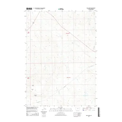
2015 Map of Mule Creek
USGS Topo · Published 2015About this map
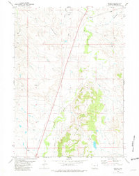
Mule Creek and its various branches, including East Mule Creek and West Mule Creek, dominate this eastern Wyoming drainage basin within Niobrara County. The landscape is defined by its water management and topography, featuring significant landmarks such as The Flat Top and the erosional paths of Jacoby Draw and Wheatgrass Draw. The human footprint here is primarily represented by the path of Old Highway 85, which cuts diagonally across the township lines. Ranching and water conservation are evident through local infrastructure like Geiger Reservoir and the Mule Creek Number 1 Reservoir, located in the southeastern portion of the quadrangle. The map highlights the intersection of several tributary systems, including Hon Creek, Sage Creek, and Bridge Creek, which feed into the larger regional watershed.
Find a feature on this map
16 named features on this map. Tap any name to fly to it.
Don’t see what you’re looking for? This feature index may not catch every label — zoom into the map to look around manually.
Map Details
Editions of this 2015 Mule Creek Map
This is the sole edition of this map. No revisions or reprints were ever made.
Other maps of this area

1951 · Twentyone Divide
USGS Topo · 1:24,000

1955 · Newcastle
USGS Topo · 1:250,000

1958 · Newcastle
USGS Topo · 1:250,000

1978 · Riverview
USGS Topo · 1:24,000

1978 · Mule Creek
USGS Topo · 1:24,000

1978 · Coffee Flats
USGS Topo · 1:24,000
1978 · Oat Creek NW
USGS Topo · 1:24,000
1978 · Mule Creek SE
USGS Topo · 1:24,000
1981 · Little Alkali Creek
USGS Topo · 1:24,000
1981 · Redbird
USGS Topo · 1:24,000