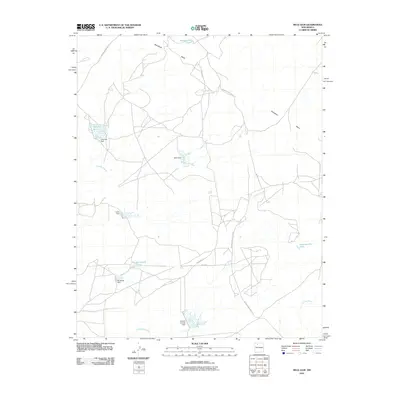
2010 Map of Mule Dam
USGS Topo · Published 2010About this map
Sisnathyel Mesa dominates this high-desert landscape in New Mexico, where water management is the primary visible human fingerprint on the land. The intricate drainage patterns of Cañada Corrales, Cañada Alamos, and Encino Wash are punctuated by a series of earthen dams and pit tanks. Notable among these is the Big Island CCC Tank, a likely remnant of Civilian Conservation Corps infrastructure, alongside the Mule Dam and Cañada Corrales Dam. Transportation is limited to specialized routes including Indian Service Route 471 and W Alamo Rd, reflecting the remote and specific utility of this terrain. This survey illustrates how seasonal water flow has been captured and diverted to sustain activity in a region defined by its aridity and sprawling mesa formations.
Find a feature on this map
18 named features on this map. Tap any name to fly to it.
Don’t see what you’re looking for? This feature index may not catch every label — zoom into the map to look around manually.
Map Details
Editions of this 2010 Mule Dam Map
This is the sole edition of this map. No revisions or reprints were ever made.
Other maps of this area

1883 · Mt. Taylor
USGS Topo · 1:250,000

1886 · Mt. Taylor
USGS Topo · 1:250,000

1889 · Largo
USGS Topo · 1:250,000

1892 · Mt. Taylor
USGS Topo · 1:250,000

1895 · Largo
USGS Topo · 1:250,000

1899 · Mt. Taylor
USGS Topo · 1:250,000

1954 · Aztec
USGS Topo · 1:250,000

1958 · Aztec
USGS Topo · 1:250,000

1958 · Albuquerque
USGS Topo · 1:250,000

1960 · Pueblo Alto Trading Post
USGS Topo · 1:24,000