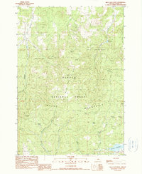
1990 Map of Mule Deer Ridge
USGS Topo · Published 1990About this map
The high ridge-and-canyon country of Och Oco National Forest is defined here by a network of seasonal springs and watercourses that supported the region's late-20th-century ranching and forest management. Rising from the drainage of Antelope Creek, the terrain climbs toward Mule Deer Ridge and the Maury Mountains, where the landscape is dotted with named water sources such as Rarey Spring, Blue Eagle Spring, and Knox Spring.
Find a feature on this map
32 named features on this map. Tap any name to fly to it.
Don’t see what you’re looking for? This feature index may not catch every label — zoom into the map to look around manually.
Map Details
Editions of this 1990 Mule Deer Ridge Map
This is the sole edition of this map. No revisions or reprints were ever made.
Other maps of this area

1946 · Eagle Rock
USGS Topo · 1:62,500

1948 · Eagle Rock
USGS Topo · 1:62,500

1951 · Post
USGS Topo · 1:62,500

1955 · Crescent
USGS Topo · 1:250,000

1955 · Bend
USGS Topo · 1:250,000

1957 · Crescent
USGS Topo · 1:250,000

1957 · Bend
USGS Topo · 1:250,000

1958 · Crescent
USGS Topo · 1:250,000

1958 · Bend
USGS Topo · 1:250,000
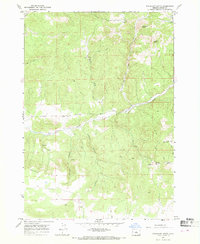
1967 · Sugarloaf Butte
USGS Topo · 1:24,000