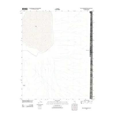
2012 Map of Mule Deer Ridge NW
USGS Topo · Published 2012About this map
Desert Lake dominates the northwest quadrant of this Lincoln County landscape, defining a wide basin between two significant mountain systems. This arid territory is bounded by the Sheep Range to the east and the East Desert Range to the southwest, illustrating the classic basin-and-range topography of the high desert. The presence of Dry Lake Spring at the base of the eastern peaks indicates a rare water source in an otherwise parched environment. Transportation through this remote expanse is limited to the lonely track of Alamo Rd, which skirts the southern edge of the lake bed, connecting the isolation of the desert flats to the distant mountain passes.
Find a feature on this map
5 named features on this map. Tap any name to fly to it.
Don’t see what you’re looking for? This feature index may not catch every label — zoom into the map to look around manually.
Map Details
Editions of this 2012 Mule Deer Ridge NW Map
This is the sole edition of this map. No revisions or reprints were ever made.
Other maps of this area

1907 · Las Vegas
USGS Topo · 1:250,000

1908 · Las Vegas
USGS Topo · 1:250,000

1945 · Sheep Range
USGS Topo · 1:125,000

1945 · Alamo
USGS Topo · 1:125,000

1954 · Caliente
USGS Topo · 1:250,000

1954 · Las Vegas
USGS Topo · 1:250,000

1957 · Las Vegas
USGS Topo · 1:250,000

1959 · Caliente
USGS Topo · 1:250,000

1959 · Las Vegas
USGS Topo · 1:250,000

1962 · Las Vegas
USGS Topo · 1:250,000