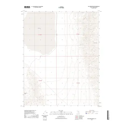
2018 Map of Mule Deer Ridge NW
USGS Topo · Published 2018About this map
Desert Lake and its surrounding alkali flats dominate the western portion of this terrain in Lincoln County. The landscape is defined by the sharp topographical rise into the Sheep Range to the east, where the arid valley floor gives way to complex mountain ridges. This 2018 survey captures the remote character of southern Nevada's basin and range province, where water sources are critical landmarks. Dry Lake Spring serves as a lone named water point on the mountain slopes, a vital feature for understanding historical movement and survival in this desert environment. Alamo Rd provides the primary north-south transit through the valley, skirting the eastern edge of the lake bed and connecting the East Desert Range foothills with the high peaks of the Sheep Range.
Find a feature on this map
9 named features on this map. Tap any name to fly to it.
Don’t see what you’re looking for? This feature index may not catch every label — zoom into the map to look around manually.
Map Details
Editions of this 2018 Mule Deer Ridge NW Map
This is the sole edition of this map. No revisions or reprints were ever made.
Other maps of this area

1907 · Las Vegas
USGS Topo · 1:250,000

1908 · Las Vegas
USGS Topo · 1:250,000

1945 · Sheep Range
USGS Topo · 1:125,000

1945 · Alamo
USGS Topo · 1:125,000

1954 · Caliente
USGS Topo · 1:250,000

1954 · Las Vegas
USGS Topo · 1:250,000

1957 · Las Vegas
USGS Topo · 1:250,000

1959 · Caliente
USGS Topo · 1:250,000

1959 · Las Vegas
USGS Topo · 1:250,000

1962 · Las Vegas
USGS Topo · 1:250,000