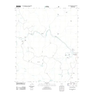
2011 Map of Mule Hoof Bend
USGS Topo · Published 2011About this map
The Sunrace Cliff Dwellings overlook the deep incision of the Salt River in this high-desert landscape of central Arizona. This survey captures a region defined by complex drainage systems and ancient human history, where the river winds through striking landforms like Mule Hoof Bend and Walnut Canyon. The presence of Phillips Mine Rd and Regal Mine Rd points to the area's legacy of resource extraction, while modern infrastructure is represented by the Seneca Lake Dam and the settlement of Seneca in the southeast. Water management is critical in this environment, evidenced by numerous tanks and springs such as Ash Spring Tank and Mormon Spring. The map also details several recreational sites including the Salt River Recreation Area and the Salt Bank Campground, illustrating the transition of the river corridor from industrial and ancient sites into a contemporary destination for outdoor activity.
Find a feature on this map
47 named features on this map. Tap any name to fly to it.
Don’t see what you’re looking for? This feature index may not catch every label — zoom into the map to look around manually.
Map Details
Editions of this 2011 Mule Hoof Bend Map
This is the sole edition of this map. No revisions or reprints were ever made.
Other maps of this area

1922 · Chrysotile
USGS Topo · 1:125,000

1946 · Blue House Mtn
USGS Topo · 1:62,500

1951 · Blue House Mtn
USGS Topo · 1:62,500

1954 · Mesa
USGS Topo · 1:250,000

1957 · Mesa
USGS Topo · 1:250,000

1958 · Mesa
USGS Topo · 1:250,000

1960 · Mesa
USGS Topo · 1:250,000

1964 · Mesa
USGS Topo · 1:250,000

1966 · Brushy Canyon
USGS Topo · 1:24,000
1966 · Haystack Butte
USGS Topo · 1:24,000