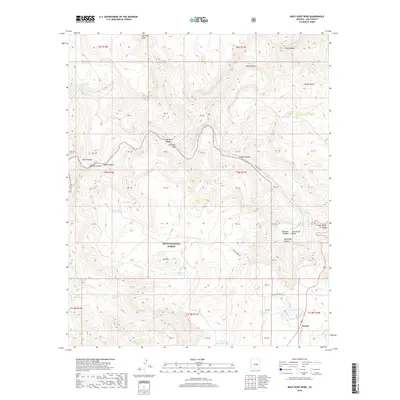
2018 Map of Mule Hoof Bend
USGS Topo · Published 2018About this map
Mule Hoof Bend creates a striking geographical horseshoe where the Salt River carves through the central portion of this 2018 survey. This landscape is defined by the dramatic descent of the Salt River Canyon and several tributary drainages including Coyote Canyon, Walnut Canyon, and Rock Canyon. The settlement of Seneca sits at the southeastern edge of the map, situated along Cienega Creek. Within the Tonto National Forest, numerous water sources such as Slick Rock Spring, Mormon Spring, and Ash Spring are noted, highlighting the essential nature of these features in the high desert terrain. Local transport is represented by the Phillips Mine Road and a Primitive Road, which navigate the elevation changes around Ash Mountain and the Salt River Valley.
Find a feature on this map
51 named features on this map. Tap any name to fly to it.
Don’t see what you’re looking for? This feature index may not catch every label — zoom into the map to look around manually.
Map Details
Editions of this 2018 Mule Hoof Bend Map
This is the sole edition of this map. No revisions or reprints were ever made.
Other maps of this area

1922 · Chrysotile
USGS Topo · 1:125,000

1946 · Blue House Mtn
USGS Topo · 1:62,500

1951 · Blue House Mtn
USGS Topo · 1:62,500

1954 · Mesa
USGS Topo · 1:250,000

1957 · Mesa
USGS Topo · 1:250,000

1958 · Mesa
USGS Topo · 1:250,000

1960 · Mesa
USGS Topo · 1:250,000

1964 · Mesa
USGS Topo · 1:250,000

1966 · Brushy Canyon
USGS Topo · 1:24,000
1966 · Haystack Butte
USGS Topo · 1:24,000