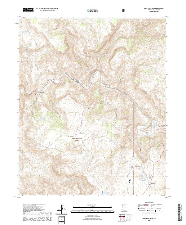
2021 Map of Mule Hoof Bend
USGS Topo · Published 2021About this map
Salt River watercourses and dramatic topographical relief dominate this portion of the Tonto National Forest in Gila County. The central feature is the sweeping meander of Mule Hoof Bend, where the river carves through Mule Hoof Canyon and into the deeper reaches of Salt River Canyon. To the south, the terrain rises toward Ash Mtn, surrounded by a network of drainage systems including Ash Cr and Cienega Cr. The small settlement of Seneca sits near the southeastern corner, connected by a sparse road network including Phillips Mine Rd. This landscape is defined by its verticality, from the high points of Coyote Butte down to the steep walls of Regal Canyon. Numerous water sources such as Slick Rock Spring and Mormon Spring are scattered throughout, indicating the vital importance of natural seeps in this arid environment.
Find a feature on this map
49 named features on this map. Tap any name to fly to it.
Don’t see what you’re looking for? This feature index may not catch every label — zoom into the map to look around manually.
Map Details
Editions of this 2021 Mule Hoof Bend Map
This is the sole edition of this map. No revisions or reprints were ever made.
Other maps of this area

1922 · Chrysotile
USGS Topo · 1:125,000

1946 · Blue House Mtn
USGS Topo · 1:62,500

1951 · Blue House Mtn
USGS Topo · 1:62,500

1954 · Mesa
USGS Topo · 1:250,000

1957 · Mesa
USGS Topo · 1:250,000

1958 · Mesa
USGS Topo · 1:250,000

1960 · Mesa
USGS Topo · 1:250,000

1964 · Mesa
USGS Topo · 1:250,000

1966 · Brushy Canyon
USGS Topo · 1:24,000
1966 · Haystack Butte
USGS Topo · 1:24,000