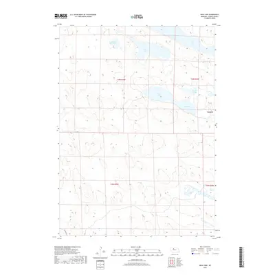
2017 Map of Mule Lake
USGS Topo · Published 2017About this map
The Nebraska Sandhills define this landscape in Cherry County, where a complex network of wetlands and namesake basins stretches across the terrain. At the heart of this region is Mule Lake, surrounded by several other distinctive water bodies including Devils Punch Bowl Lake and Dads Lake. This area of the Great Plains is characterized by its internal drainage and sparse settlement, with the locality of Conterra serving as a primary named point of reference.
Find a feature on this map
14 named features on this map. Tap any name to fly to it.
Don’t see what you’re looking for? This feature index may not catch every label — zoom into the map to look around manually.
Map Details
Editions of this 2017 Mule Lake Map
This is the sole edition of this map. No revisions or reprints were ever made.
Other maps of this area

1950 · Simeon
USGS Topo · 1:62,500

1950 · Kennedy
USGS Topo · 1:62,500

1951 · Bull Lake
USGS Topo · 1:62,500

1951 · Brownlee
USGS Topo · 1:62,500

1957 · Valentine
USGS Topo · 1:250,000

1959 · Valentine
USGS Topo · 1:250,000

1985 · Goose Creek
USGS Topo · 1:100,000

1985 · Valentine
USGS Topo · 1:100,000
1985 · Kennedy
USGS Topo · 1:24,000
1985 · Brownlee
USGS Topo · 1:24,000