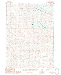
1985 Map of Mule Lake
USGS Topo · Published 1986About this map
Isolated ranchsteads like Daniels Ranch and Pound Ranch dot the rolling sandhills of Cherry County, defining the human footprint in this expansive grassland environment. The landscape is characterized by a high concentration of interdunal lakes and wetlands, much of which is preserved within the Valentine National Wildlife Refuge. Large water bodies such as Mule Lake and the sprawling Dads Lake provide critical habitat in a region where water and grass dictate the rhythm of life.
Find a feature on this map
14 named features on this map. Tap any name to fly to it.
Don’t see what you’re looking for? This feature index may not catch every label — zoom into the map to look around manually.
Map Details
Editions of this 1985 Mule Lake Map
This is the sole edition of this map. No revisions or reprints were ever made.
Other maps of this area

1950 · Simeon
USGS Topo · 1:62,500

1950 · Kennedy
USGS Topo · 1:62,500

1951 · Bull Lake
USGS Topo · 1:62,500

1951 · Brownlee
USGS Topo · 1:62,500

1957 · Valentine
USGS Topo · 1:250,000

1959 · Valentine
USGS Topo · 1:250,000

1985 · Goose Creek
USGS Topo · 1:100,000

1985 · Valentine
USGS Topo · 1:100,000
1985 · Kennedy
USGS Topo · 1:24,000
1985 · Brownlee
USGS Topo · 1:24,000