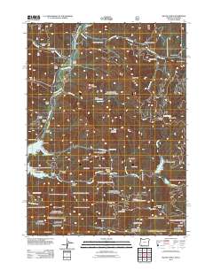
2011 Map of Mule Mountain
USGS Topo · Published 2011About this map
Mule Mountain rises over a landscape defined by the drainage of the Applegate River and the industrial infrastructure of the Applegate Dam. This 2011 survey captures the transition of the Rogue River National Forest into a recreational and managed wilderness, where the Applegate Lake reservoir has reshaped the original canyons. Remnants of the region's mining and grazing history are evident in features like the Placer Mine near Sourdough Gulch and the high-elevation clearings at Carlton Pasture and Ash Flat.
Find a feature on this map
68 named features on this map. Tap any name to fly to it.
Don’t see what you’re looking for? This feature index may not catch every label — zoom into the map to look around manually.
Map Details
Editions of this 2011 Mule Mountain Map
This is the sole edition of this map. No revisions or reprints were ever made.
Other maps of this area

1886 · Shasta
USGS Topo · 1:250,000

1891 · Ashland
USGS Topo · 1:250,000

1893 · Ashland
USGS Topo · 1:250,000

1894 · Shasta
USGS Topo · 1:250,000

1897 · Ashland
USGS Topo · 1:250,000

1908 · Grants Pass
USGS Topo · 1:125,000

1914 · Seiad
USGS Topo · 1:125,000

1922 · Seiad
USGS Topo · 1:125,000

1932 · Yreka
USGS Topo · 1:96,000

1938 · Medford
USGS Topo · 1:125,000