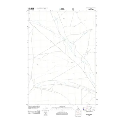
2011 Map of Mulkey Bar
USGS Topo · Published 2011About this map
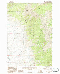
Little Lost River winds along the eastern edge of this landscape, marking a crucial water source in the arid Custer County interior. This 2011 survey illustrates a region defined by its drainage systems, where seasonally vital flows like Wet Creek and Dry Creek converge near the alluvial formation of Mulkey Bar. The transport network follows these natural contours, with the Little Lost Hwy and Pahsimeroi Rd providing the primary transit corridors through the basin. Higher elevations are marked by landmarks such as Deer Flats and the secluded Magpie Springs, showing the distribution of water in an environment where it dictates both settlement and movement. Genealogists and local historians can trace the paths of historic cattle and travel routes that have connected these creek valleys for generations, including Sawmill Canyon Rd and Pass Creek Rd.
Find a feature on this map
18 named features on this map. Tap any name to fly to it.
Don’t see what you’re looking for? This feature index may not catch every label — zoom into the map to look around manually.
Map Details
Editions of this 2011 Mulkey Bar Map
This is the sole edition of this map. No revisions or reprints were ever made.
Other maps of this area

1955 · Dubois
USGS Topo · 1:250,000

1956 · Nicholia
USGS Topo · 1:62,500

1957 · Diamond Peak
USGS Topo · 1:62,500

1957 · Gilmore
USGS Topo · 1:62,500

1957 · Hawley Mountain
USGS Topo · 1:62,500

1958 · Dubois
USGS Topo · 1:250,000
1987 · Mulkey Bar
USGS Topo · 1:24,000
1987 · Hawley Mountain
USGS Topo · 1:24,000
1987 · Warren Mountain
USGS Topo · 1:24,000
1987 · Bell Mountain
USGS Topo · 1:24,000