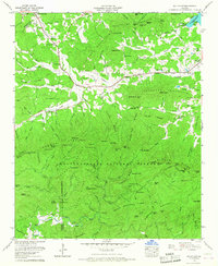
1965 Map of Mulky Gap
USGS Topo · Published 1967About this map
Chattahoochee National Forest dominates this mid-1960s landscape, where the ridges of northern Georgia transition between the Union and Fannin county line. Local life centers on the valleys along Youngcane Creek and Jones Creek, where the rural infrastructure of the era is evident in places like the Youngcane Sch and Philadelphia Ch. The map captures a moment when the regional landscape was managed for both conservation and community, illustrated by the Cooper Creek Scenic Area and the Mulky Gap Camping Area tucked into the mountain gaps.
Find a feature on this map
114 named features on this map. Tap any name to fly to it.
Don’t see what you’re looking for? This feature index may not catch every label — zoom into the map to look around manually.
Map Details
Editions of this 1965 Mulky Gap Map
This is the sole edition of this map. No revisions or reprints were ever made.
Other maps of this area

1886 · Dahlonega
USGS Topo · 1:125,000

1888 · Ellijay
USGS Topo · 1:125,000

1892 · Dahlonega
USGS Topo · 1:125,000

1892 · Ellijay
USGS Topo · 1:125,000

1896 · Dahlonega
USGS Topo · 1:125,000

1898 · Ellijay
USGS Topo · 1:125,000

1903 · Dahlonega
USGS Topo · 1:125,000

1911 · Ellijay
USGS Topo · 1:125,000

1935 · Coosa Bald
USGS Topo · 1:24,000

1935 · Ivylog
USGS Topo · 1:24,000