
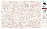
1985 Map of Mullen
USGS Topo · Published 1985About this map
The North Branch Middle Loup River and South Branch Middle Loup River converge in this mid-1980s study of the Nebraska Sandhills, a landscape defined by an intricate network of wetlands and valleys. The Burlington Northern railroad serves as the primary east-west corridor, connecting the small communities of Mullen, Whitman, Hyannis, and Ashby. This infrastructure mirrors the path of the cattle industry, with ranching life centered around the numerous water bodies like Clear Lake and Blue Crane Lake that dot the interdunal valleys.
Find a feature on this map
98 named features on this map. Tap any name to fly to it.
Don’t see what you’re looking for? This feature index may not catch every label — zoom into the map to look around manually.
Map Details
Editions of this 1985 Mullen Map
2 editions found
Other maps of this area

1947 · Dismal River Ranch
USGS Topo · 1:62,500

1948 · Seneca
USGS Topo · 1:62,500

1948 · Ashby
USGS Topo · 1:62,500

1948 · Bingham
USGS Topo · 1:62,500

1948 · Carr Lake
USGS Topo · 1:62,500

1948 · Mullen
USGS Topo · 1:62,500

1948 · Spade Ranch
USGS Topo · 1:62,500

1948 · George Lake
USGS Topo · 1:62,500

1948 · Whitman
USGS Topo · 1:62,500

1948 · Spring Valley
USGS Topo · 1:62,500